
RandoViewers Week 3 Results
A shift in protocol

Early in the preparations for this program, I planned for several phases. The first two weeks represented phase 1, a simple “view the coordinates” protocol. The second phase, which started with week 3 presented a slightly different approach to test a hypothesis: Could the viewers see a location if I hadn’t been there yet? Are we viewing the coordinates, the Randonautica intention, or both? In week 2, almost all of the RVs saw not only the location but something hidden which was consistent with the intention: VEIL. So far, the results of week 1 and 2 follow my hypothesis that not only can anyone do this, but that my personal conscious experience of a place, that being the intention set to determine the location, could also be viewed. So what happens if I haven’t been to the location and personally experienced the intention? This is what weeks 3 and 4 will be about.
The intention: DEVIL
I’ve been using Exeter, New Hampshire as my base for coordinates and thought I’d change things up this week. I popped one town over to Hampton, which is where I grew up and promptly forgot that wireless reception there is non-existent for my carrier so I had to drive down to the last place I wanted to go in the summer, Hampton Beach. There’s a lot of haunted shit down there to see and it’s not the shit hole that it used to be but it’s also extremely busy in the summer and I just don’t like the vibes down that way. The word DEVIL seems appropriate. I set the intention, pressed the button, saw the pin and then drove home. A week later I had several sets of results in from my RVs so I drove down to the location and took some pictures to compare the session data to. The location was entrance to the Hampton Beach State Park.
I’m not sure that the intention matches the coordinates at all but also, Randonautica isn’t a perfect system. I get a positive result about 75% of the time. So maybe this week is a miss.
The Coordinates: 42.8990994,-70.8162349


Viewer #1

There was a lot of noise in Viewer #1’s signal but as you can see in the notes, they saw something close to where I ended up. What I thought was interesting was the note about grey skies. It was raining when I set the intention and received the coordinates but on the day I dropped in on the site it was clear skies and sunny.
The dusty and road comments are definitely on point and the yellow could be the sand. Fluttering fabric could be the flags on the pole.
Viewer #2
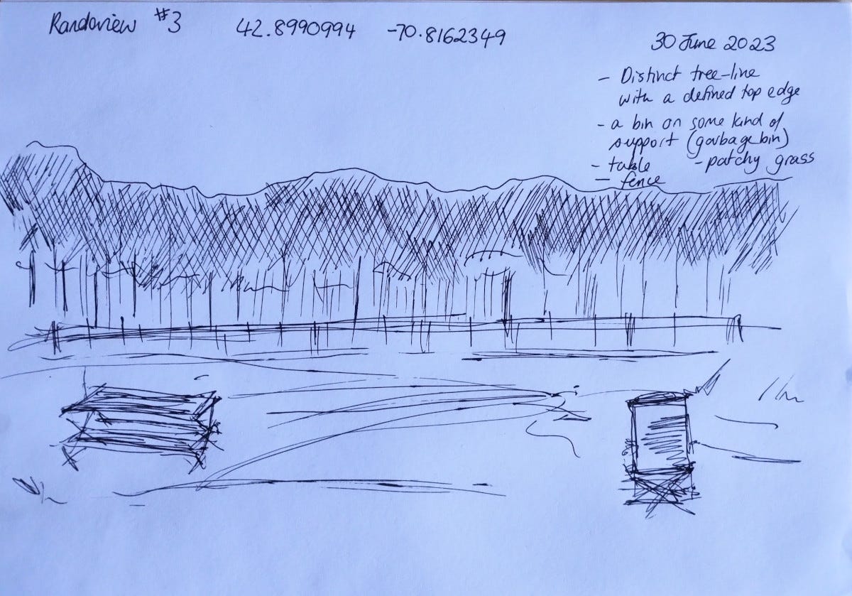
There’s definitely picnic tables and chairs around, not to mention the patchy grass but the rest of the data couldn’t be further from the mark. It looks like it’s describing a park which is what the location is but there’s no trees speak of, really. There’s a bit of sand dunes at the spot and the visitor buildings. On the other side of those details is the Atlantic Ocean in all its vastness.
Viewer #3
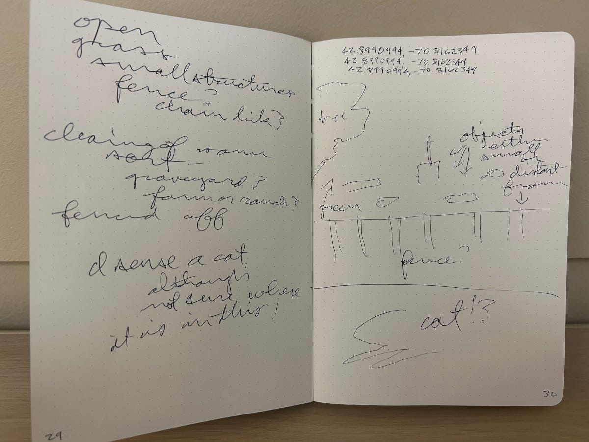
I could see the fence in this one being mistaken for the picnic area under the roof and the smaller objects nearby being the buildings for the parking attendants. But the more I look at these results the more I wonder what effect my direct experience with the location has a bearing on the viewing. Everyone was so on point in the last two weeks. Not to make this sound like there’s something wrong with the RVs, quite the opposite. I think that my direct experience with the location at the time that I receive the coordinates has an impact on the viewers ability to see it. Since I didn’t actually go to the spot until after I had the data the results are hazy. Now, I’ve been to this location before. I grew up around there. I worked down there like every other kid from Hampton but I haven’t been to this particular location in some time. I’m wondering if they’re drawing from my hazy experience of the spot.
Viewer #4


Now this is closer than I was expecting. We’ve got the road on the way in, the sign for the park, notes about water, which is just beyond view. They even note the presence of a park. There’s notes there about a sense of decay or disrepair, which definitely describes Hampton Beach. It’s not as bad as it used to be but much of that location is driftwood apartments just waiting for a spark to bring them down. Every few years a fire breaks out at one end or the other that threatens to set the entire strip on fire.
I’m wondering if some of the trouble also stems from there not being much to see at the location. It is rather barren.
Viewer #5
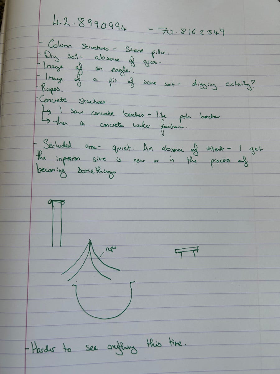
The last note on this one really drives it home. Everyone in this round was somewhere in the neighborhood but the results were super hazy.
Conclusion
I’m tempted to go back to something safe and give everyone a set of coordinates that I know and have direct experience with but a second week of this protocol ought to help me understand things better or simply prove that this was an off-week for the RVs.
Stay tuned.
Viewer 5 the reason is the power plant probably blocks remote viewing
If u go to Seabrook beach i swear there is a portal there go over the bridge and I think it’s on Woodstock street there is a random property that is empty and there is a giant cement hole it’s like a park it’s so bizarre